Green’s Farms Church & the West Parish of Fairfield, 1711-1736

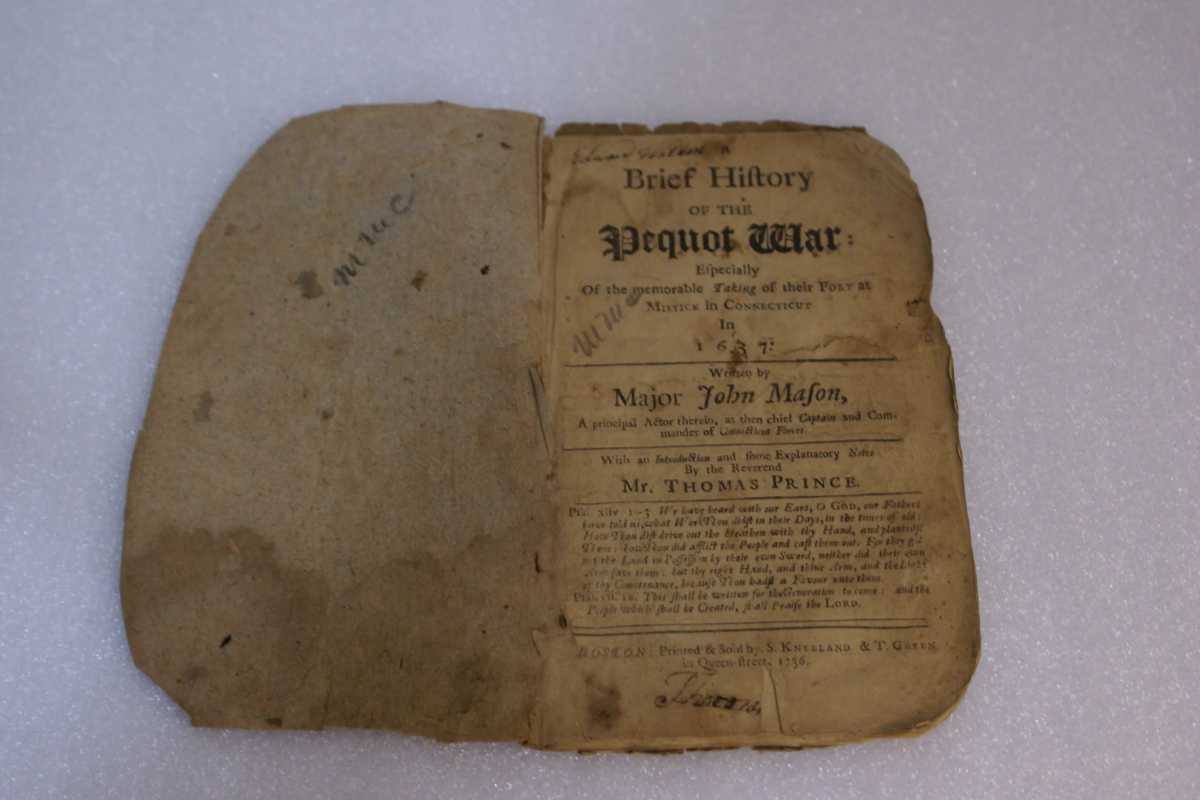
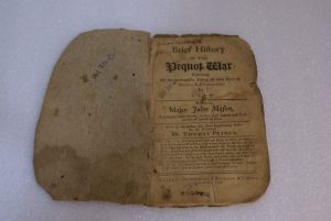
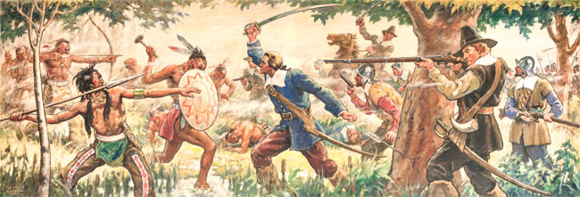
The establishment of the Congregational Church of America dates back to the founding of this nation with the arrival of religious dissenters from England to Massachusetts Bay Colony in 1620. Called Puritans in England — a derogatory term referring to their zeal for simplicity in church organization and worship — they believed each church should be organized with members who enter a covenant agreement and had the right to choose their own minister.

In the 1630s and 1640s, thousands of Puritans arrived in New England and flourished with the conviction that they were chosen by God to play a central role in the unfolding of this new land and human history at large. As such, churches and church leaders played an important role in shaping New England society. The organizational system of Congregational churches required mutual trust and personal commitment, yet this was not always a given. Voting in Massachusetts was limited to individuals who had been formally admitted to the church after a detailed interrogation of their religious views and experiences. Thomas Hooker disagreed with the limitation of suffrage in the Massachusetts Colony and in 1636, led one hundred followers to found Hartford. After 1636, freeman (eligible voter) settlements were formed throughout Connecticut.

In 1639, Roger Ludlowe and a group of settlers from Windsor came to modern day Fairfield and formed The First Church of Fairfield. By 1644, Fairfield was the fourth largest town among the colony’s nine towns and extended from Stratford to Norwalk. As populations grew and church attendance was mandatory, groups began campaigning for the right to establish their own parishes.  In 1708, the Bankside farmers, Thomas Newton, John Green, Henry Gray, Daniel Frost and Francis Andrews started their petition to form the West Parish of Fairfield, which is the modern day Green’s Farm Church in Westport.

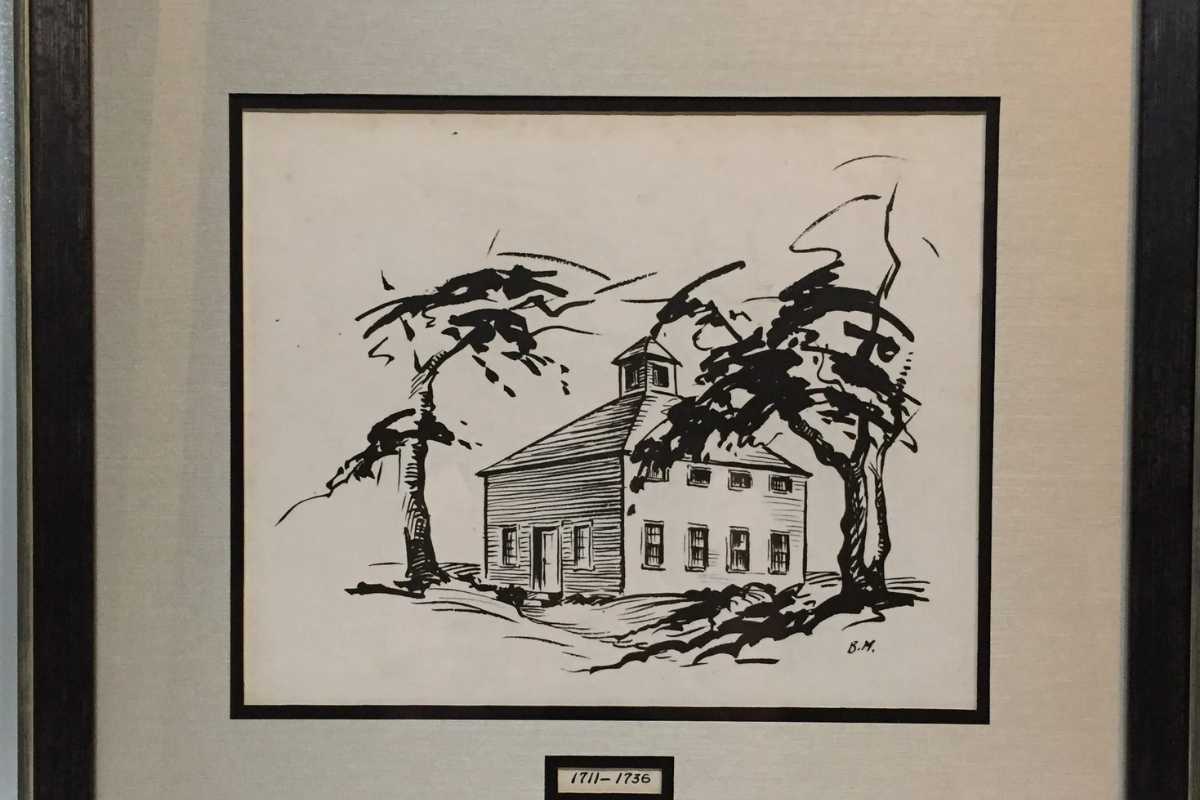
Green’s Farms Church, 1711 – 1736 

Rendering by unknown artist

Loan from Green’s Farms Church 

In 1708, a group of Fairfield residents commonly known as the Bankside farmers petitioned the Connecticut Colonial Legislature for permission to leave Fairfield Parish.  They wanted to establish a parish closer to their homes in the area between the current Weston center to the north, Long Island Sound as the southern border, the Saugatuck River to the west, and today’s West Parish Road as the eastern boundary. After a three-year debate ensued, the Legislature granted their request in 1711.  

The first parish meeting was held on June 12, 1711, and Reverend Daniel Chapman was chosen as minister, with the promise of 70 pounds annual salary and one year’s worth of firewood. The modest meetinghouse, pictured here, took nine years to build and was 35 square feet wide and 16 feet high, with 4 ½ foot wide clapboard siding. It stood on the common at Green’s Farms Road and Morningside Drive, commemorated today by the Machamux boulder. 

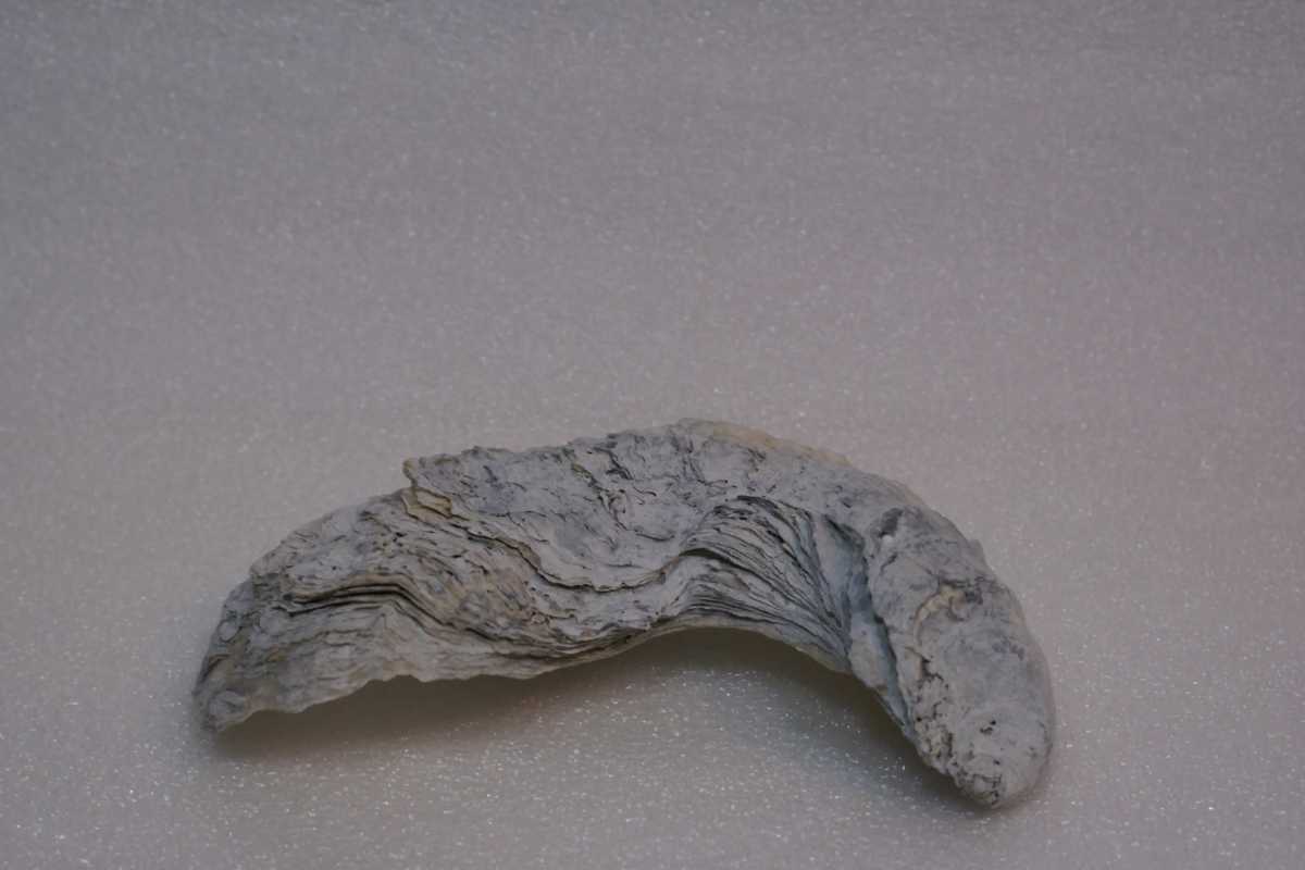
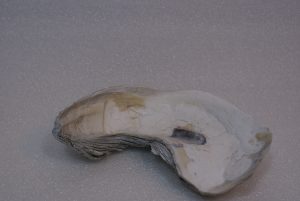
Tea Bowl and Saucer, c. 1720 

Ceramic 

Loan from Green’s Farms Church 

This tea bowl and saucer belonged to Reverend Daniel Chapman, the first minister of Green’s Farms Church. The congregation paid for Chapman’s ordination in 1714, and he  served the West Parish of Fairfield for 31 years. Porcelain was costly in the 18th century and common folks used pewter or even wood vessels. Reverend Chapman, in contrast, likely had a full set as evidenced by the five remaining pieces the church still owns.  

Tea was also an expensive 18th century indulgence. The fact that Reverend Chapman owned a full set indicates he was highly valued and lived in refined style. The earliest tea cups had no handles and were referred to as tea bowls.  In the 18th century, saucers were typically very deep compared to modern day saucers. It is believed that tea was poured from the bowl to the saucer to cool and was then drunk from the saucer.

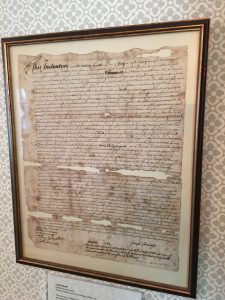
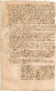
Green’s Farms Church Covenant, 1742 

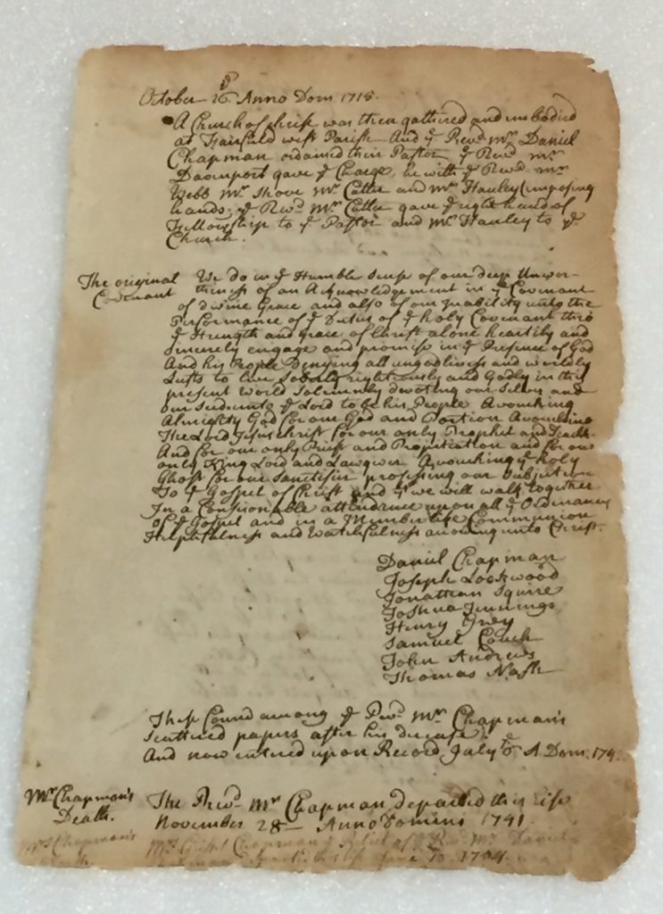
Rewritten Copy of 1711 Document 

Courtesy of Fairfield Museum and History Center 

As they formed a new congregation in 1711, one of the first orders of business for the Bankside farmers was to create a covenant of faith. The covenant outlined the expectations of the congregation…”Denying all ungodliness and worldly Lusts, to live Soberly, righteously and Godly in this present world.” It was signed by the original settlers of Green’s Farms: Joseph Lockwood, Jonathan Squire, Joshua Jennings, Henry Gray, Samuel Couch, John Andrews, and Thomas Nash who later became known as the Bankside Farmers. 

Bankside Farmers, 1648-1711

Back in 2018, Westport Museum (then Westport Historical Society) did a year-long exhibit called “History of Westport in 100 Objects” in which we shared the nearly four hundred year history of the town using different objects. We are bringing back that always-popular exhibit here–virtually. Check back each week for a new post and photos of items that tell our collective story. Have a suggestion for an object to include? Email us a photo and description at virtualmuseum@westporthistory.org and we’ll consider including it on our facebook page.

When Connecticut was a British colony, the area east of the Saugatuck River to the border of Fairfield and west of the Mill River was known as Green’s Farms. Thomas Newton, John Green and Henry Gray were given a land grant to settle the area in 1648 with Daniel Frost and Francis Andrews joining them within a few years. The group later became known as the Bankside Farmers. In subsequent generations, others like Joshua Jennings possessed landholdings encompassing a large parcel of Green’s Farms. 

Settlers cultivated the rich soil of Greens Farms initially for their own subsistence and later for commercial profit. Positioned on the Long Island Sound, Green’s Farms was also a seafaring community which tapped into the export trade. Flax was grown for linen, and corn–also known by the Native name maize–was grown for the settlers’ families, their cattle, and for export to the Caribbean where it was used to feed enslaved people. 

Food was also harvested from the sea and fish, clams, and oysters were part of the bounty. Fish and lobsters were so plentiful they were also used for fertilizer. 

Firearms, c. 1820

Mixed-metal firearm remnants (2) 

Private Collection of Peter Jennings

Colonists used firearms to defend themselves and their livestock, but they were also an important part of farming life for hunting everything from ducks to deer.  Still in its infancy, firearm design was of the flintlock type where a piece of stone was used with a trigger mechanism to create a spark and ignite the powder charge inside the barrel.  Some flintlocks were converted to a percussion mechanism after the 1820’s, as shown in these examples, that were unearthed during excavation around Compo Beach. 

Oyster Shell

Shell

Private Collection of Norman Bloom

Typically only a few inches long today, oysters breed in beds, often in shallow waters where they can be gathered by hand or with small rakes.  Early settlers cultivated oysters that were as large as dinner plates.  In the 18th century, oyster rakes were used from small boats to gather oysters in deeper waters; and in the 19th century, long-handled tongs made the job easier.  By the latter 19th century, scallop dredges were attached to boats to scrape oyster beds at the bottom of the ocean floor.  Because dredges tended to damage the beds, their use was highly restricted.  Dredging was limited to sailboats until 1969 to control over-harvesting in Connecticut, and the oyster sloop was designed for this purpose.  Built in 1948, Hope is considered the last-built Connecticut oyster sloop. 

Land Deed, 1703-1704

Ink, Parchment

Private Collection of Peter Jennings

This document, written July 4, 1703 and signed March 20, 1704 by Joseph Jennings was witnessed by Thomas Staples and John Meredith.  It describes the transfer of a property from Joshua Jennings “of Fairfield in Connecticut Colony in New England” to Joseph Jennings, for a piece of land in the Mill River vicinity, now known as Green’s Farms.  The Jennings family were among the largest landowners and farmers in the area, and in 1850 were the largest landowners in Westport. 

Land Grant, 17th Century

Scan of Original

Fairfield Town Clerk 

Copy of the original land grant to John Green, Henry Gray, Thomas Newton, Daniel Frost, and Francis Andrews.  These men became known as the Bankside Farmers in the area we call today Green’s Farms. 

A Town Born from Battle, 1637

Back in 2018, Westport Museum (then Westport Historical Society) did a year-long exhibit called “History of Westport in 100 Objects” in which we shared the nearly four hundred year history of the town using different objects. We are bringing back that always-popular exhibit here–virtually. Check back each week for a new post and photos of items that tell our collective story. Have a suggestion for an object to include? Email us a photo and description at virtualmuseum@westporthistory.org and we’ll consider including it on our facebook page.

There was no “Westport” in the 1630s. Instead, using the Saugatuck River as the boundary, the town was divided between Fairfield and Norwalk. On the Fairfield side, many farmers settled along the Long Island Sound–amidst the original settlements of the Paugusset Natives who were “cousins” and allies of the larger, more powerful Pequot tribe.

By 1637, there was all out “war” between the two groups. Originating in Massachusetts, Europeans hounded the Pequots all the way to the swampy area between what is now Southport and Greens Farms. The massacre that ensued was called the Great Swamp Fight and effectively ended the war and the Native presence in this part of the colony.

The Native People who survived were either absorbed by other tribes or sold into slavery. Over the years, their presence has been erased except for the now familiar place names they left behind like Saugatuck and Aspetuck.

Powderhorn, 19th Century 

Unknown Artist 

Animal horn and wood 

WHS Collection, Unnumbered 

Animal horns were commonly used throughout the Colonial period of Connecticut to hold gunpowder. Horns from cattle or oxen were readily available and popular with militiamen before the adoption of paper cartridges. Susceptible to sparks and explosions, metal receptacles could not be used to hold powder but other containers, known as powder flasks, crafted from leather or wood, were employed. The powderhorn seen here would have been refilled through the large opening, with powder poured through the tapering end for each shot, and worn slung over the shoulder from a leather strap. Powderhorns were used both by hunters and the militiamen raised under orders of the Colonial Governor to engage Native People in battles for territory. A powderhorn such as this one would have likely been used by colonists during battles like the Great Swamp Fight at the border of present day Greens Farms and Southport. 

Arrowheads, 12oo BC-950 AD 

Unknown Native People 

Quartz and Quartzite 

WHS Collection, 1978.11.5 (1-5) 

Arrowheads found in Connecticut date back as early as 1,400 years ago as seen at the Tower Hill Road Site in the southeastern part of the state. Many of the arrowheads over this timespan were made from quartz and quartzite, and their designs varied. The Mohegan, Pequot, Pocumtuc, and Narragansett people were based in southern New England for thousands of years. Native People hunted wild game and fought tribal wars using arrows outfitted with these sharp stone heads. As white settlers arrived, conflicts ensued such as the King Philip’s and Pequot Wars including the Great Swamp Fight just past today’s Green’s Farms on the border of Southport. While white settlers used guns, Native Peoples attempted to protect their land using bow and arrow. Arrowheads found today help historians track the paths of these conflicts. 

A First Hand Account of the Pequot War1637 (published 1736) 

Major John Mason

Book, stitched parchment in custom board/leather binding box

WHS Collection,  30073 

On July 13, 1637, Major John Mason, Captain and Commander of the Connecticut forces, brought his men to battle with Native People during the Pequot War in swampy land in what is today Southport in the area where I-95 crosses over the Post Road. This is an original surviving copy of that account first published in 1736.  Pages 15-18 describe the Swamp Fight. Mason’s militia men comprised local farmers.  The Sachem of the Pequot, Sassacus, was captured along with some 180 men, women, and children of the Pequot tribe–making this the last official battle of the war. You can see a monument dedicated to the battle in the center divider at the intersection of Post Road and Old Post Road near the Athena Diner in Southport today.  

“We then Marching on in a silent Manner, the Indians that remained fell all into the Rear, who formerly kept the Van; (being possessed with great Fear) we continued our March till about one Hour in the Night: and coming to a little Swamp between two Hills, there we pitched our little Camp.” 

Pequot War Mural, 1937 

Scan of Original Painting 

Courtesy of Fairfield Museum and History Center

Depictions such as this Great Depression era mural by artist George Avison told a romanticized—if inaccurate—story about the Great Swamp Fight. Similar to other  art commissioned by the Works Progress Administration to glorify the era of American nation building, this mural was one in a series of five murals depicting Fairfield’s history. Completed in 1937 and hung in the Roger Ludlowe High School building, now known as Tomlinson Middle School, where all five remain today as a reminder that history is most often told through the eyes of the “victors.” 

Battlefields of the Pequot War 

Courtesy of Fairfield Museum and History Center Pequot War Battlefield Project 

This map created by the Fairfield Museum and History Center as part of a multi-year collaboration with the National Park Service American Battlefield Protection Program shows the locations of the Connecticut battle areas in the Pequot War. The Southport site has been mapped topographically to create a site plan for professional archaeologists to conduct low-impact field analysis of the Pequot Swamp battle site to locate possible artifacts. To learn more, please visit the Pequot War Battlefield Project at fairfieldhistory.org